


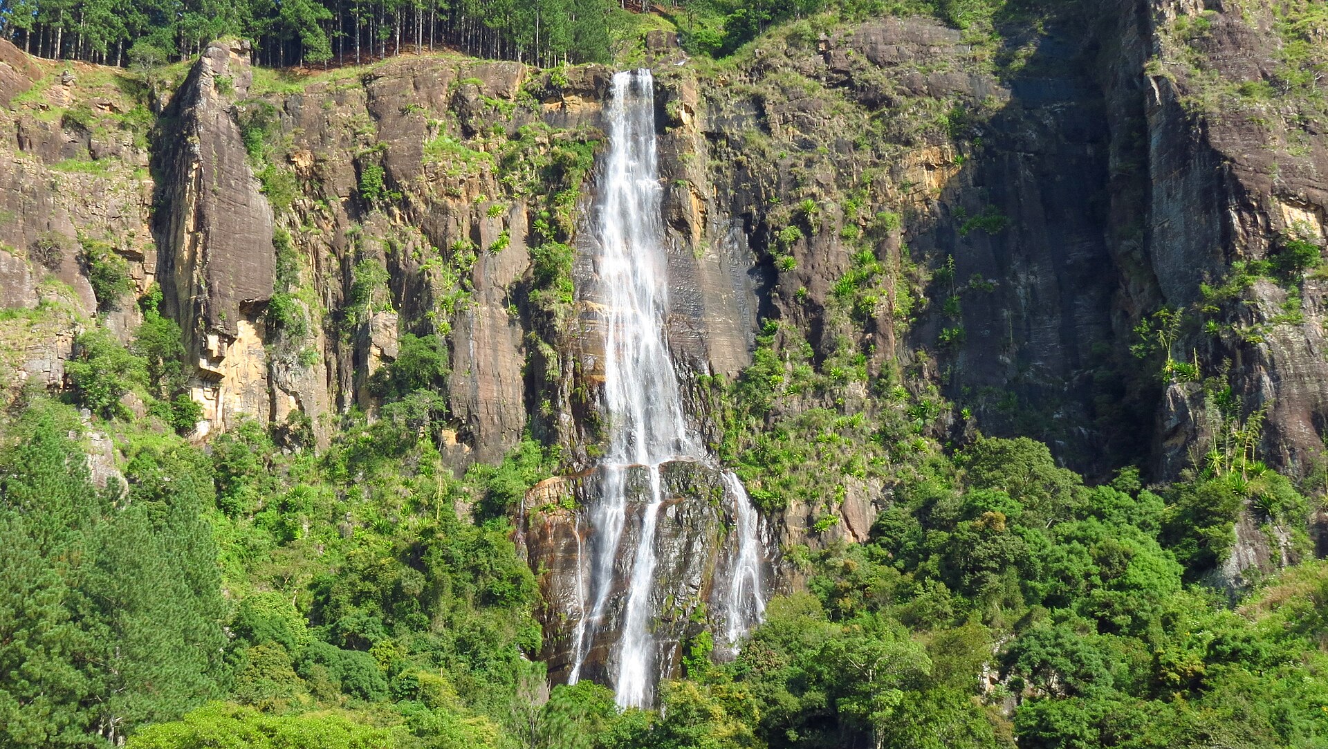
The Devil’s Staircase is the hill-country hike that Sri Lankan hikers recommend to each other — a roughly 14 km mountain route between Kalupahana, down on the Colombo–Badulla A4 road, and Ohiya railway station high on the plateau. In one long morning you climb from lowland heat through tea estates and cloud forest, pass close to the country’s tallest waterfall, and finish at a railway station where you can flag the next train onward. It is not technical, but it is long, steep, and far more rewarding than its modest fame suggests.
This guide covers the route as we know it — directions, honest difficulty, what it costs, and the mistakes that turn a great day into a slog.
Why is it called the Devil’s Staircase?
The name comes from the road itself. The upper section climbs through a series of improbable hairpin bends cut into the mountainside — switchbacks stacked so steeply that, as the local story goes, no human engineer would have dared plan them, so the devil must have built the road. Stand at the bottom of the zigzags looking up and the story makes sense.
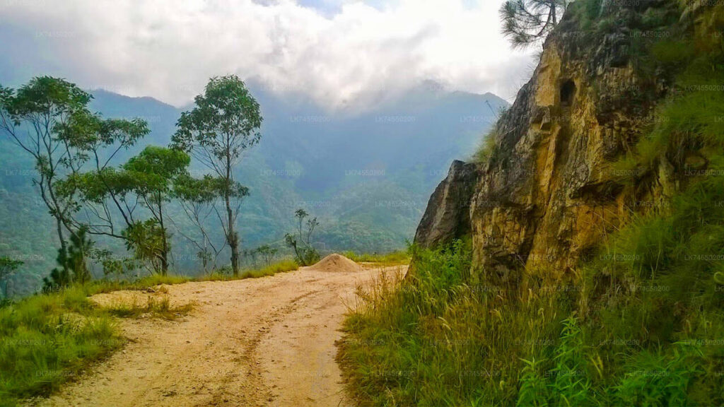
Despite the name, this is a walkable estate road for most of its length — rough concrete and gravel used by the occasional jeep and three-wheeler — not a scramble. Your legs will complain about the gradient, not the terrain.
Quick facts
| Route | Kalupahana → Ohiya (reversible) |
| Distance | ~14 km |
| Time | 5–6 hours uphill; 4–5 downhill |
| Elevation gain | Roughly 1,000 m (Kalupahana ~700 m → Ohiya ~1,750 m) |
| Difficulty | Moderate — long and steep, not technical |
| Best months | January to March; April and August decent |
| Cost | Effectively free — transport is your only expense |
| Guide needed? | Not essential for navigation; see below |
The route, section by section
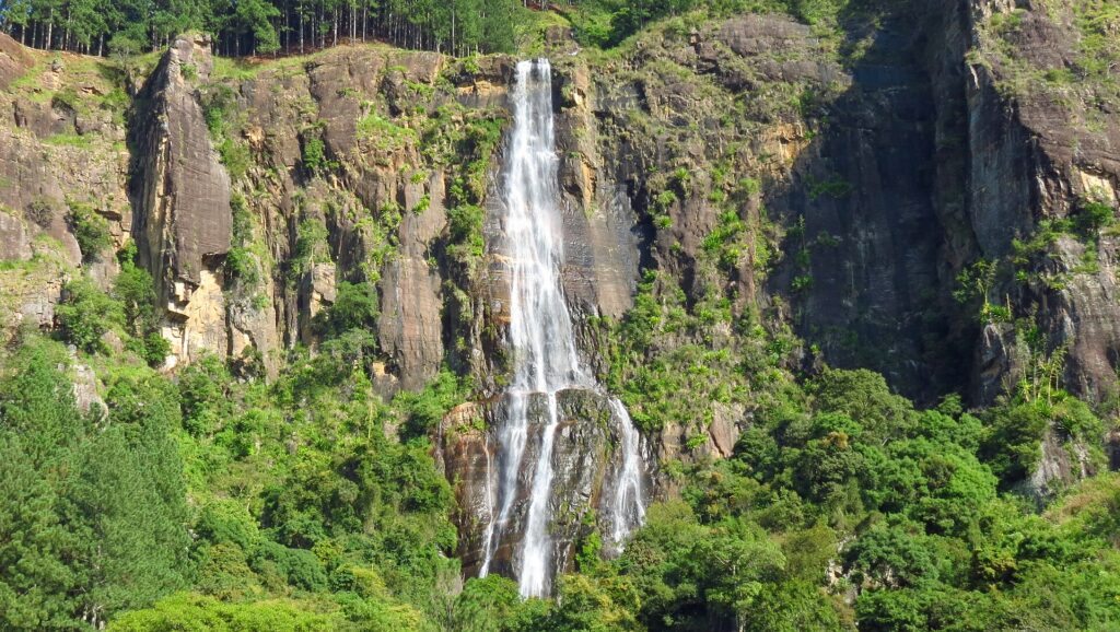
1. Kalupahana to Bambarakanda Falls (~3 km). The walk starts gently from Kalupahana junction on the A4, following the estate road uphill. Within the first hour you reach the detour to Bambarakanda Falls — at 263 metres, the tallest waterfall in Sri Lanka. It is directly on this route and skipping it would be absurd; budget 30–45 minutes. The falls are at their thundering best from March to May and after rain; in deep dry season the flow thins to a ribbon.
2. The tea-estate climb. From the falls the road climbs steadily through the V-shaped gap in the mountains, past estate line houses and working tea slopes. There is little shade on long stretches — this is where an early start pays off. Water sources are unreliable; carry at least two litres per person.
3. The staircase itself. The famous hairpins. This is the steepest sustained section and the one that earns the hike its name — count the bends if you need a distraction. The reward is immediate: with every switchback the view back down the valley toward the southern plains gets wider.
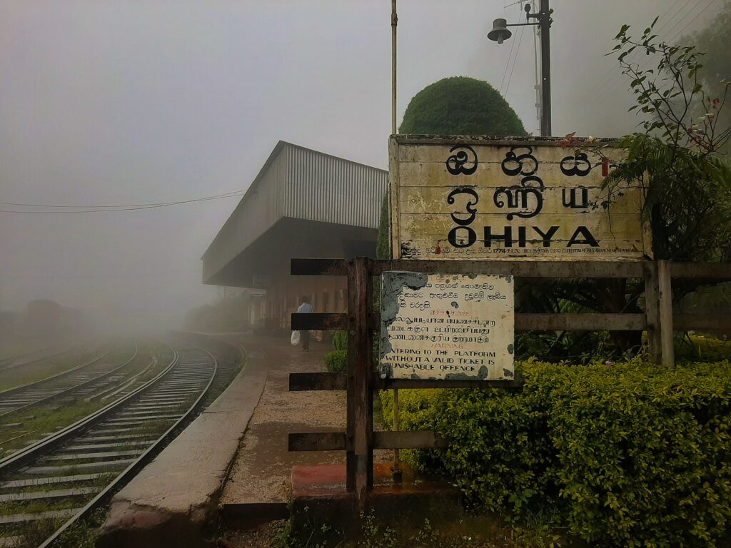
4. The plateau to Ohiya (~final 4 km). The gradient relents and the landscape changes completely — cool air, pine and cloud forest, mist drifting across the road. The route ends at Ohiya railway station, a tiny highland stop on the Main Line, where a cup of plain tea from the shop opposite the station tastes better than it has any right to.
Getting to the Devil’s Staircase trailhead
By bus: any Colombo–Badulla bus along the A4 passes Kalupahana junction — tell the conductor and they’ll drop you at the trailhead turn-off. From Colombo it’s a long ride (5–6 hours); from Haputale or Belihuloya it’s under an hour. Fares are a few hundred rupees at most — verify current fares locally, as they change.
By tuk-tuk: from Haputale to Kalupahana is a practical option if you overnight in Haputale for an early start. Agree the price before getting in.
Finishing by train: this is the elegant part of the plan — hike up, then catch a train from Ohiya onward toward Ella, Haputale, or back down-country. Important 2026 note: the highland railway suffered serious cyclone damage in late November 2025 and services on parts of the Main Line have been altered, with the Kandy end suspended at the time of writing. Check the current timetable with Sri Lanka Railways or at any staffed station before relying on an onward train from Ohiya — and have a tuk-tuk fallback in mind.
Which direction? Kalupahana → Ohiya (uphill) gives the classic sense of achievement and the train finish. Ohiya → Kalupahana (downhill) is significantly easier on the lungs but harder on the knees, and works well if you arrive by morning train. Honest answer: uphill for fitness and bragging rights, downhill for photography and comfort.
Do you need a guide on the Devil’s Staircase?
For navigation, no — the route follows one road, and it’s hard to get meaningfully lost. That said, a local guide earns their fee in other ways: waterfall side-trips (Lanka Ella and other cascades hide off the main route), estate shortcuts, and the stories behind the line houses you pass. If you’d rather support the local economy and learn something, hire one in Kalupahana or through your Haputale guesthouse; agree the price up front. Solo hikers and couples do this route unguided every week.
What it costs (per person)
| Item | LKR (approx.) |
|---|---|
| Bus Colombo → Kalupahana | a few hundred (verify current fare) |
| Bambarakanda Falls | free |
| The trail itself | free |
| Lunch/snacks carried | 500–1,000 |
| Train Ohiya → Ella/Haputale | under 300 (2nd class band) |
| Optional local guide | negotiate locally |
This is one of the cheapest full-day adventures in Sri Lanka — the entire day can cost less than a single cocktail on the Ella strip.
Practical tips we mean seriously
- Start by 7 am. Midday sun on the shadeless middle section is the single biggest reason people suffer on this hike.
- Two litres of water minimum. Refill options are scarce and unreliable.
- Leeches are active in and after the wet months — socks over trousers and a dab of salt or soap solve most of it. Dry season, barely an issue.
- Weather turns fast above the staircase. A light rain layer weighs nothing and can save the day.
- Phone signal is patchy in the valley sections — download an offline map before you start.
- Tell someone your plan. Standard hill-country practice; conditions and daylight are less forgiving than the coast.
Frequently asked questions
Can beginners do the Devil’s Staircase? Reasonably fit beginners, yes — the challenge is stamina, not skill. If 14 km with 1,000 m of climbing sounds like too much, do the Ohiya-to-Kalupahana downhill version or just visit Bambarakanda Falls from Kalupahana as a short out-and-back.
Is it safe solo? By hill-country standards, yes — it’s a used estate road, not wilderness. The usual rules apply: early start, offline map, someone knows your plan.
Can you drive it? Jeeps and trail bikes use the road, and some visitors do it as a 4×4 trip. Walking is the point, though — in a vehicle it’s a bumpy road; on foot it’s one of the island’s best days out.
When is Bambarakanda Falls at its best? After rains — roughly March to May and October to December. In the driest weeks the falls shrink dramatically.
Where should I stay? Haputale is the most convenient base (early trailhead access, good guesthouses); Belihuloya works from the low side; finishing in Ella the same evening is entirely doable via Ohiya.
More hill-country routes: our guides to Wangedigala — the neighbouring peak that shares this trailhead — Horton Plains National Park, Lipton’s Seat, and the best hiking areas in Sri Lanka.
Route information and weather patterns are referenced against the Department of Meteorology seasonal outlooks. Last updated July 2026 — trail and rail conditions change; tell us via the contact page if you find something outdated.
Video Vlogs – Devil’s Staircase Real experience by Bikes